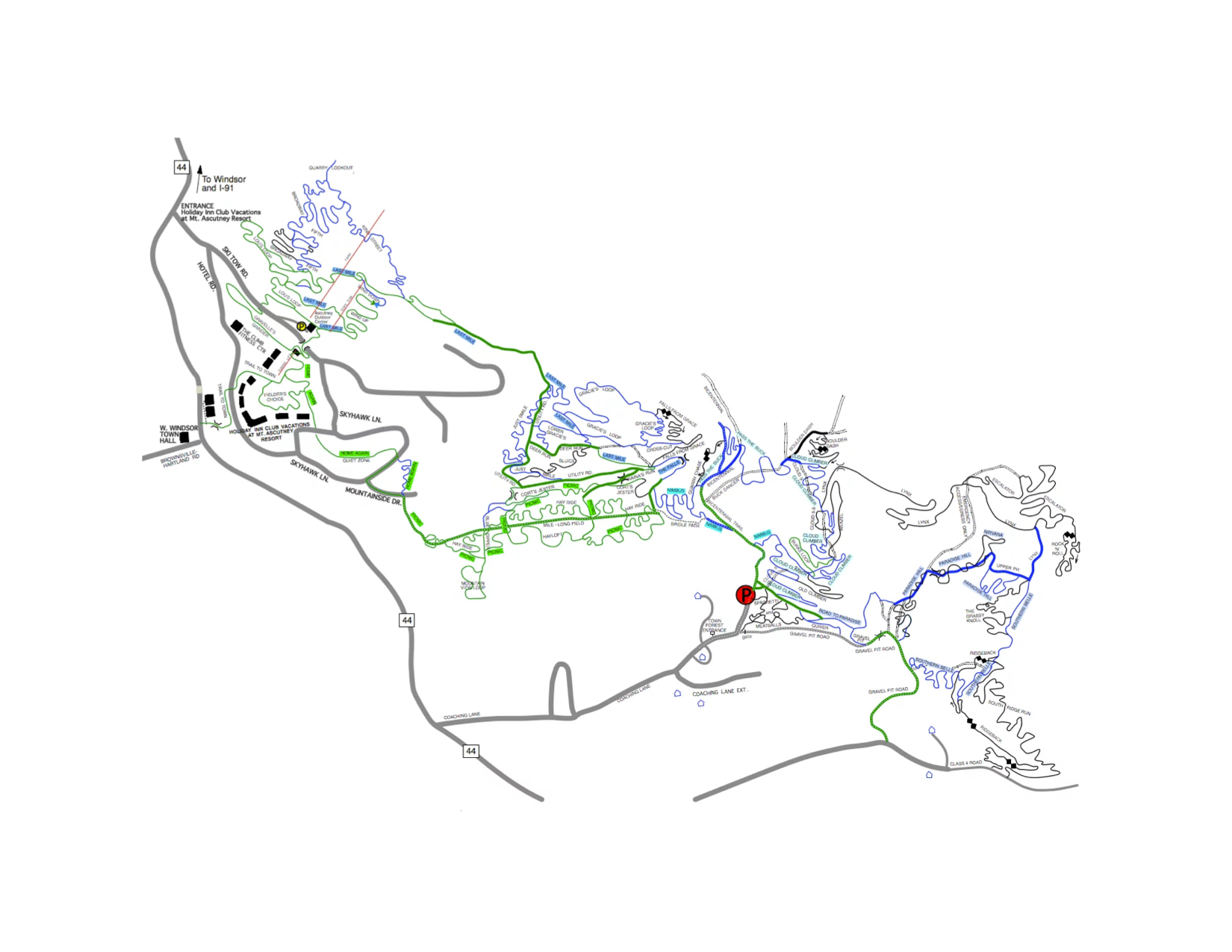
In the land around the Ascutney Outdoors Center, you’ll find about 35 miles of mapped and marked mountain bike trails located within the former ski area and the adjacent West Windsor Town Forest, as well as private lands. Most of these trails were carefully planned and built by the mountain bike enthusiasts at our sister organization, the Ascutney Trails Association.
The trails are routed to guide you through some of the most beautiful and diverse terrain in New England, the hand-built trails stand as a premier destination for mountain-bikers from all over the Northeast. The trails offer an enjoyable riding experience for mountain-bikers of all skill levels, including challenging trails for advanced riders.

Trail Maps and TRAILFORKS
Trail maps are posted on the outdoor bulletin boards at the Ascutney Outdoors Center and the Town Forest Parking lots. Trail maps are also available locally at the Brownsville Butcher & Pantry. Trailforks is the most extensive source of trail information and conditions, as well as suggested loops and difficulty.
Three trail-heads offer something a little different. Please see “trail head locations” for directions.
Ski Tow Rd/Ascutney Outdoors Center – these trails offer riding for beginner, intermediate and advanced riders with primarily single-track terrain: switchback climbs, bridges and boardwalks, technical rock features and cruisy mountain traverses.
Town Forest/Coaching Lane – Riding from here is better suited to intermediate and advanced riders and offers a variety of primarily single-track terrain: rock gardens, rollers, bridges, up and down through forest glades, bermed flow trails and some ‘old school’ technical sections.
State Park Trail-head – The 3.5-mile trail network here is novice and kid-friendly, but intermediate-enjoyable with single and double-track terrain: flat and gently undulating through the woods, bridges and boardwalks, switchbacks, dirt rollers and one big hill to challenge all skill levels.